

There are 2 series of walks by Colin Peter, the first is a series of community walks around Llysfaen (section below), the second is a series of road walks around Llysfaen and its surroundings by following minor roads, which are accessible to pushchair users and are all-weather, avoiding the wet, muddy footpaths we are all familiar with in wet winters.
This series of walks has been developed to assist anyone to enjoy Llysfaen and its surroundings through following footpaths, minor roads and open access land. The walks are all circular, starting from several points around the village, but they can be started or finished anywhere to suit the walker. They usually range in distance from 3.1km (1.9 miles) to 5.3km (3.3 miles) but the Llysfaen Parish walk is considerably longer at 12.9km (8 miles). When walking in Llysfaen, there is usually a degree of ascent and descent involved; overall ascent ranges from 86m (283’) to 250m (820’) although the Parish walk has a total height climbed of 430m (1411’).
Anyone who is reasonably fit should find the walks easy; they are not, however, designed for people who struggle with walking, nor for pushchairs nor wheelchairs. Any stiles are mentioned in the introduction to each walk, kissing gates abound.
Distances are given in miles and kilometres, total ascent in feet and metres. Times quoted are approximate, based on two and a half miles per hour (4km per hour) with an addition for overall ascent; time for stopping and chatting are not included.
All routes have been mapped out on Ordnance Survey online mapping (https://osmaps.ordnancesurvey.co.uk/), but maps are not included in the walk descriptions due to copyright issues. The route descriptions with associated photographs should enable straightforward following of the routes.
Almost all footpaths within the village are included over the series of walks. Those public rights of way shown on OS maps as a green dotted line, without the underlying black pecked line symbol, have not been included; these indicate that although there is a public right of way there is no footpath on the ground.
Note that there are no longer any toilet facilities in the village!
There are several hyperlinks, shown in blue, underlined text, in the walk descriptions that in the digital version give access online to the relevant website for more detailed information. Clearly these will not be available from any printed version you may wish to produce.
All walks are undertaken at your own risk. They have all been walked, albeit by an experienced walker(s) and any particular points of concern have been noted in the text. Since some of the paths cross farmland, there is always the possibility of meeting farm animals (as with any public right of way in the area). If you are concerned about this do not follow the route! Dog walkers should be particularly wary where sheep, cows or horses are present.
Since most of the routes involve footpaths, they are likely to be affected by periods of wet weather; it may be worth avoiding them in these conditions so that you do not get wet and muddy (with increased risk of slipping and falling) and you do not cause deterioration of the paths’ surface.
Should you find any of the route descriptions incorrect or misleading, or should you have any other comments, please in the first instance pass them on to the Clerk who will forward them to the walks’ author. Hopefully we can then get them amended and updated on the website.
The Ordnance Survey maps at 1:25 000 have been used extensively, mostly in the form of online maps OS maps online (a subscription service), but Conwy County Borough Council’s website has a section on public rights of way where all ROWs can be seen on detailed OS map or satellite background Conwy Council ROWs.
The older series of Ordnance Survey large scale maps can be investigated at Old OS maps and give useful insight into Llysfaen around 1900.
Welsh Tithe Maps give an even earlier look at Llysfaen (around 1839).
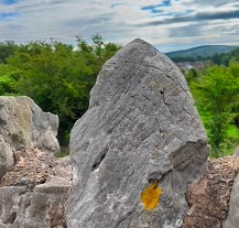
The British Geological Survey’s “Geology of Britain viewer” is an online tool that provides detailed maps of Britain, including Llysfaen. Links provide details of the geological formations shown on the map. BGS viewer. The 3D version is particularly impressive.
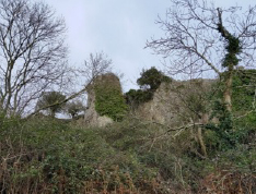
The Welsh government’s Historic Environment Service Cadw has a good online tool which covers Wales in detail. You can zoom in and find information on sites of interest. Several such sites have been referenced in the route descriptions.
The series of books by Joan Davies on the history of Llysfaen are now provided as scanned pages by the Community Council on their website.
All photographs and route descriptions are copyright of the author, Colin Peter.
Name: Llysfaen Central
Route: Ffordd y Llan, Mynydd Marian nature reserve, Bron y Llan Rd., path to Dolwen Rd., path to Gadlas Rd., Glyndwr Rd., Dolwen Rd. Two stiles and kissing gate on second detour.
Start and finish: St. Cynfran’s Church, Pentregwyddel Rd.
OS Grid Ref.: SH 893 774
Parking: room for a few cars; do not obstruct the bus route. Further parking in the Mynydd Marian carpark just off Bron y Llan Road (uphill, opposite).
By bus: 14 or 15, rarely 13
Distance: 3.1km (1.9miles)
Total ascent 102m (334 ft.)
Time: 56 minutes
Terrain: village roads, public footpaths in open country, woodland and field paths and tracks.
Grade: Easy; few slopes, but none very steep. Several stiles, kissing gates. Rarely muddy, some paths stony.
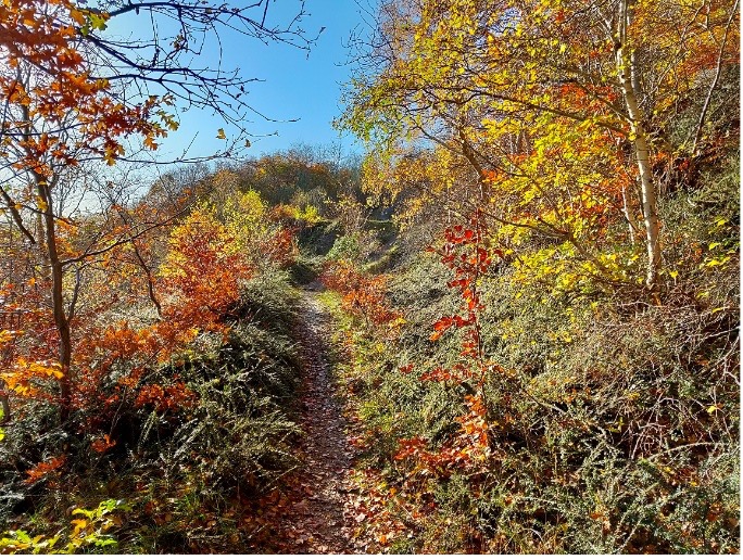
Summary: A walk in quiet open country with fine views over the sea and distant views of the Clwydian Hills and Carneddau Mountains.
Route: Isallt Road, North Wales Path, Maidens Leap, Plas Farm, Dolwen Road
Start and finish: Old Bus terminus
OS Grid Ref: SH 892 768
Parking: room for a few cars; do not obstruct the bus turning.
By bus: 14 or 15
Distance: 5.3km (3.3miles)
Total ascent 202m (662 ft.)
Time: 1 hour 40 minutes
Terrain: public footpaths in open country, field paths, minor roads.
Grade: Easy; few slopes, but none steep. Few stiles including ladder stiles; kissing gates. Rarely muddy, some paths stony.
Summary: A walk in quiet open country with fine views over the Dolwen Valley and distant views of Clwydian Hills and Carneddau Mountains.
Name: Llysfaen North-1
Route: Gadlas Road, Quarry path, Abergele Road, North Wales Path, Maidens Leap, Pentre Du Farm, Trawscoed Road, paths to Gadlas Road
Start and finish: Post Office, Gadlas Road
OS Grid Ref: SH 898 773
Parking: On road.
By bus: 14 or 15
Distance: 5.3km (3.3miles)
Total ascent 250m (820 ft.)
Time: 1 hour 45 minutes
Terrain: public footpaths in open country, field paths, woods, some roads (pavements).
Grade: Moderate to severe; few steep slopes, Few stiles including ladder stiles; kissing gates. Rarely muddy, some paths stony.
Summary: A walk downhill to Llanddulas on a quarry path, then ascend steeply on the North Wales Path to below Maiden’s Leap. Through fields and woods back to start. Fine views over the sea and Dulas Valley and distant views of Clwydian Hills and Carneddau Mountains.

Name: Llysfaen North-2
Route: Gadlas Road, Quarry path, Abergele Road, Wern Road, Beach road, North Wales Path, Maidens Leap, Plas yn Llysfaen, Gadlas Road,
Start and finish: Post Office, Gadlas Road
OS Grid Ref: SH 898 773
Parking: On road.
By bus: 14 or 15
Distance: 5.3km (3.3miles)
Total ascent 250m (820 ft.)
Time: 1 hour 45 minutes
Terrain: public footpaths in open country, field paths, woods, some roads (pavements).
Grade: Moderate to severe; few steep slopes, Few stiles including ladder stiles; kissing gates. Rarely muddy, some paths stony.
Summary: A walk downhill to Llanddulas on a quarry path, then to the beach, up beside the river, ascend steeply on the North Wales Path, circle the quarry up to Maiden’s Leap and back to start. Fine views over the sea and Dulas Valley and distant views of Clwydian Hills and Carneddau Mountains.

Name: Llysfaen Parish Bounds
This walk traces, as closely as practicable, the outline of Llysfaen Parish (strictly, the parish of St. Cynfran).
The parish boundary is shown on Ordnance Survey maps at 1:25 000 scale, but is probably best traced from more detailed maps available online from Cadw. To the south the boundary follows streams, so the route follows nearby roads. In the east the boundary is approximately the Afon Dulas, and to the north the boundary runs into the sea. The western boundary runs through Penmaenrhos quarries and streets before heading south cross-country to join the stream that flows through Old Colwyn.
Route: Isallt Road, Pencoed Road, Llindir Road, Tan yr Allt Road, Abergele Road, Wern Road, Beach Road, Wales Coast Path, Rainbow Bridge, Steps to Penmaenhead, Abergele Road, Highlands Road, Berth y-Glyd, Llysfaen Road, walkways to Craig Road, Peulwys Lane, footpaths, North Wales Path, Bwlch y Gwynt Road
Start and finish: Old Bus terminus
OS Grid Ref: SH 892 768
Parking: room for a few cars; do not obstruct the bus turning.
By bus: 14 or 15
Distance: 12.9km (8 miles)
Total ascent 430m (1411ft.)
Time: 3 hours 55 minutes
Terrain: Mostly on minor roads and surfaced paths, limited section on public footpaths through fields and woods.
Grade: Moderate to severe; few steep slopes, steep flights of steps up to Penmaenhead, kissing gates. Paths may be wet and muddy after prolonged rain.
You will see that some of the photographs were taken during a very wet winter when the paths and fields were muddier than usual; it is worthwhile waiting for drier conditions to fully appreciate the walk or to bypass the southern paths by following Peulwys Lane, Berth-y-Glyd, Tan-y-Graig Road and Geulan Road to Bwlch-y-Gwynt Road where you re-join the original route.
Summary: A long downhill section followed by a steep climb, then downhill, steeply at first, to Llanddulas Beach. Along the mostly level Wales Coast Path to the Rainbow Bridge, strenuously up steps to Penmaenhead, through streets and walkways to Peulwys Lane. Pleasant paths to join the North Wales Path which is followed through woods, fields and village lanes back to the start.

Name: Llysfaen Southeast
Route: Bryn Defaid, Pentre Du, Plas yn Llysfaen and Trawscoed Road
Start and finish: Old Bus terminus
OS Grid Ref: SH 892 768
Parking: room for a few cars; do not obstruct the bus turning
By bus: Arriva 14 or 15
Distance: 3.5km (2.2miles)
Total ascent 86m (283 ft.)
Time: 1 hour
Terrain: public footpaths in open country, field paths, minor roads.
Grade: Easy; few slopes, but none steep. Few stiles including ladder stiles; kissing gates. Rarely muddy, some paths stony.
Summary: A walk in quiet open country with fine views over the Dolwen Valley and distant views of the Clwydian Hills and Carneddau Mountains.

Name: Llysfaen West
Route: Dolwen Road, Bwlch y Gwynt Road, Coed Mawr, Golf course, Ty Mawr, Mynydd Marian, Tan y Graig Rd.
Start and finish: Old Bus terminus
OS Grid Ref: SH 892 768
Parking: room for a few cars; do not obstruct the bus turning
By bus: Arriva 14 or 15
Distance: 5km (3.1miles)
Total ascent 183m (600 ft.)
Time: 1 hour 33 minutes
Terrain: public footpaths in open country, field paths, woods, minor roads.
Grade: Moderate; some steep ascents. Mainly kissing gates with rare stiles and ladder stiles. Rarely muddy, some paths stony.
Summary: A walk in quiet open country and through deciduous woods, later with fine views out to sea, to the Clwydian Hills and Carneddau Mountains.

Name: Llysfaen Wild West
Route: Tan y Graig Road, paths to Geulan Rd., Tan y Graig Rd., Ty Uchaf Farm, Marian Bach, Peulwys Lane, Ty Mawr, return via Tan y Graig Rd. or Mynydd Marian
Start and finish: Old Bus terminus
OS Grid Ref: SH 892 768
Parking: room for a few cars; do not obstruct the bus turning
By bus: Arriva 14 or 15
Distance: 4.4km (2.8miles)
Total ascent 165m (542 ft.)
Time: 1 hour 22 minutes
Actual time will be longer, depending on how overgrown the paths are.
Terrain: public footpaths-often rough and overgrown- in open country, field paths, woods, minor roads.
Grade: Moderate; some steep ascents. Mainly kissing gates with rare stiles and ladder stiles. Some paths rough, uneven, overgrown, stony.
Summary: A walk in quiet open country and through broadleaf woods, later with fine views out to sea, to the Clwydian Hills and Carneddau Mountains.
This second series of walks has been developed to assist people in enjoying Llysfaen and its surroundings by following minor roads, which are accessible to pushchair users and are all-weather, avoiding the wet, muddy footpaths we are all familiar with in wet winters. The walks are all circular, starting from several points around the village, but they can be started or finished anywhere en route to suit the walker. Equally they do not have to be followed in the clockwise (or anti-clockwise) way described. They range in distance from 3.2km (2 miles) to 6.3km (3.9 miles). with overall ascent ranging from 55m (180’) to 164m (538’).
Distances and ascents have been taken from Ordnance Survey online mapping (https://osmaps.ordnancesurvey.co.uk/), but maps are not included due to copyright issues. The route descriptions with their associated photographs should enable straightforward following of the routes. Times quoted are approximate, based on two and a half miles per hour (4km per hour) with an addition for overall ascent; time for stopping and chatting is not included.
Many of you will already be familiar with all the roads included in these RoadWalks, but hopefully some of the information may be new to you.
Note that there are no longer any toilet facilities in the village!
There are several hyperlinks, shown in blue, underlined text, in the walk descriptions that in the digital version give access online to the relevant website for more detailed information. Clearly these will not be available from any printed version you may wish to produce.
All walks are undertaken at your own risk. You may well be familiar with all the routes and there is a degree of overlap in the descriptions from the earlier “footpath walks”. Any particular points of concern have been noted in the text. The main risk is clearly associated with traffic, although traffic on minor roads is usually slight and on roads within the village there is usually a pavement.
Should you find any of the route descriptions incorrect or misleading, or should you have any other comments, please in the first instance pass them on to the Clerk who will forward them to the walks’ author. Hopefully we can then get them amended and updated on the website.
Data Sources
The Ordnance Survey maps at 1:25 000 have been used extensively, mostly in the form of online maps OS maps online (a subscription service), but Conwy County Borough Council’s website has a section on public rights of way where all ROWs can be seen on detailed OS map or satellite background Conwy Council ROWs.
The older series of Ordnance Survey large scale maps can be investigated at Old OS maps and give useful insight into Llysfaen around 1880.
Welsh Tithe Maps give an even earlier look at Llysfaen (around 1839).
The British Geological Survey’s “Geology of Britain viewer” (BGS viewer) is an online tool that provides detailed geological maps of Britain, including Llysfaen. Links provide details of the geological formations shown on the map. The 3D version is particularly impressive.
The Welsh government’s Historic Environment Service has a good online tool Coflein which covers Wales in detail. You can zoom in and find information, including photographs, on sites of interest. Several such sites have been referenced in the route descriptions.
Also from the Welsh government, Cadw has very good detailed OS maps with sites of historic interest indicated; the depiction of Llysfaen’s parish boundary is particularly clear.
The series of six books by Joan Davies on the history of Llysfaen (Llysfaen – our village; printed by Gwasg Carreg Gwalch) were provided as scanned pages by the Community Council on their old website and hopefully will find their way to the new version. They provide lots of information on the history of the village.
The book “Walks from Colwyn Bay” (Christopher Draper, publ. Gwasg Carreg Gwalch) features one walk each in Llanddulas and Llysfaen and provides detailed historical information.
All photographs and route descriptions are copyright of the author, Colin Peter.

Name: RoadWalk 2 Nant y Clyd
Route: Isallt Rd., country lanes, Isallt Rd.
Start and finish: Old Bus terminus
OS Grid Ref: SH 892 768
Parking: room for a few cars; do not obstruct the bus turning
By bus: Arriva 14 or 15
Distance: 5km (3.1 miles)
Total ascent: 143m (470 ft.)
Time: I hour 32 minutes
Grade: Moderate; some long hills, locally steep.
Summary: A walk south of the village in open country.
Risks: None of the roads have pavements; traffic is generally light, particularly when beyond Isallt Rd.

Name: RoadWalk 3 Pen y Cefn
Route: Dolwen Rd., country lanes, Isallt Rd.
Start and finish: Old Bus terminus
OS Grid Ref: SH 892 768
Parking: room for a few cars; do not obstruct the bus turning
By bus: Arriva 14 or 15
Distance: 4.8km (3 miles)
Total ascent 134m (438 ft.)
Time: I hour 25 minutes
Grade: Moderate; some long hills, locally steep.
Summary: A walk south of the village in open country.
Risks: None of the roads have pavements; traffic is generally light, particularly when beyond Isallt Rd.
After prolonged wet weather the back road turning left off Dolwen Road may locally be covered in water to depth of a few inches, but is quite passable in walking boots (though trainers are not recommended)
Name: RoadWalks 4 and 4a Dulas Valley
Route: Dolwen Rd., Isallt Rd., Cwymp Rd., Llindir Rd., Pentregwyddel Rd.
Start and finish: St. Cynfran’s Church
OS Grid Ref: SH 893 775
Parking: room for a few cars; do not obstruct the bus route,
By bus: Arriva 14 or 15
Distance: 5.9km (3.7 miles)
Total ascent 147m (483 ft.)
Time: 1 hour 43 minutes
Grade: Moderate; some long hills, locally steep.
Summary: A walk through the centre of the village, returning via the Dulas Valley.
Risks: Few of the roads have pavements; traffic is generally light, particularly away from the village.
Name: RoadWalk 5 Pen y Cefn – Nant y Clyd circular
Route: Dolwen Rd., country lanes, Isallt Rd.
Start and finish: Old Bus terminus
OS Grid Ref: SH 892 768
Parking: room for a few cars; do not obstruct the bus turning
By bus: Arriva 14 or 15
Distance: 6.3km (3.9 miles)
Total ascent 188m (616 ft.)
Time: 1 hour 54 minutes
Grade: Moderate; some long hills, locally steep.
Summary: A walk south of the village in open country.
Risks: None of the roads have pavements; traffic is generally light, particularly when beyond Dolwen Rd.
After prolonged wet weather the back road turning left off Dolwen Road may locally be covered in water to a depth of a few inches, but is quite passable in walking boots (though trainers are not recommended).

Name: RoadWalk 6 A547 Clobryn Rd
Route: Ffordd y Llan, Berth y Glyd, Highlands Road, Abergele Road, Clobryn Road, Pentregwyddel Road.
Start and finish: St. Cynfran’s Church
OS Grid Ref: SH 893 775
Parking: room for a few cars; do not obstruct the bus turning, or use the Marian Nature Reserve car park off Bron y Llan Rd.
By bus: Arriva 13, 14 or 15
Distance: 3.9km (2.5 miles)
Total ascent 141m (463 ft.)
Time: 1 hour 13 minutes
Grade: Moderate; fairly steep hills up and down
Summary: A walk around the northern part of the village.
Risks: Most of the roads have pavements (parts of Ffordd y Llan, Clobryn and Pentregwyddel Roads are exceptions; beware speeding traffic on these).